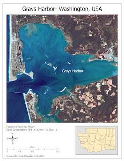
Lab 4 Maps Identifying Features
Here is a taste of what I learned in Lab 4 of my journey. To create these maps, I had to use the four steps to identify features in ERDAS which are, Examine the histogram, Visually examine the image as greyscale, Visually examine the image as multispectral and Use the inquire cursor. With these steps, I was able to identify these three features, Mountains, a Harbor, and a body of Water. I used different band combinations for each map that I felt made each singular feature the most apparent.


Comments
Post a Comment